
When Watersheds Suddenly Become Relevant
On June 11 and 12, 2023, heavy rain pounded the Malheur River corridor, unusual in its intensity and amount of rain for that time of year. This came after an already unusually wet winter and spring, with the ground saturated with moisture. This intense weather, paired with conditions on the ground, were the perfect conditions for flooding and mudslides that ensued. One can only imagine the sound as literal tons of earth and rock made its way down the steep slopes around Jonesboro, crashing to a stop at the ranch and on top of Highway 20. In places along the highway, the slide debris were over 15 ft deep.

Courtesy of Oregon Department of Transportation
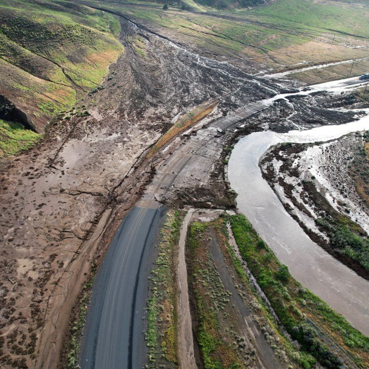
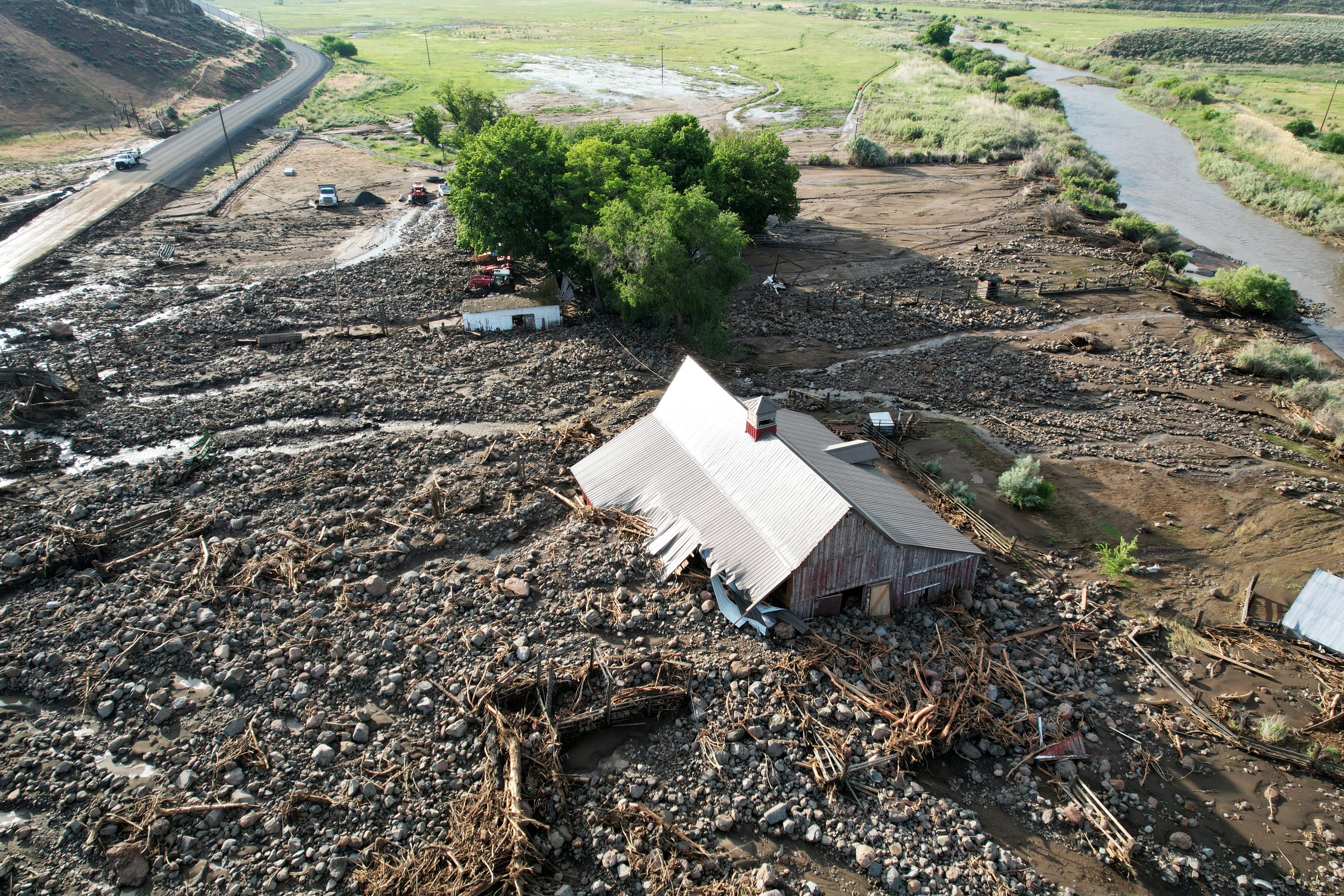
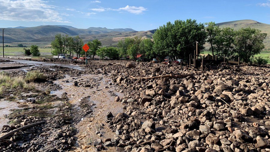
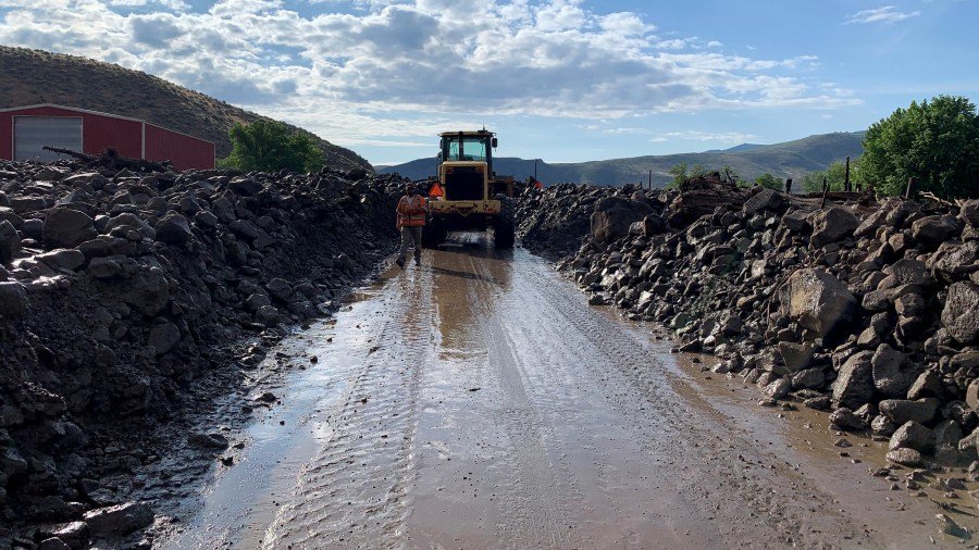
Fortunately, no lives were lost in this natural disaster, but the extent of the damage was severe. Three travelers were trapped between two sections of highway covered by the slide, according to ODOT. It took several days for ODOT crews, working 24/7, to clear one-way lane for traffic to flow through, sending travelers on a four-hour long detour until then. Such extensive damage was done to the Jonesboro Ranch headquarters, owned by the Burns Paiute Tribe, that a “Major Disaster Declaration” through FEMA was approved by President Biden to supplement response and recovery efforts.
As travelers started to make their way through the Highway 20 corridor again- with delays for recover work lasting several months - many people observed the large scars on the mountain sides and the piles of debris along the highway, wondering how it happened. A few major factors played into this event, outlined here.
The Storm
As anyone from the area can attest, the intensity of this storm was certainly unusual. Without a weather station in the area, exact measurement of the timing and amount of rain can’t be determined for certain, but using estimates provided by the Advanced Hydrologic Prediction Service (AHPS) through the National Weather Service, it is estimated that 2-3 inches of rain fell on those days. To put that in context for the area, annual precipitation for the region is 10 inches. This came after an already unusually wet winter and spring, so the ground was saturated with moisture. Precipitation amount, duration, and intensity are important storm characteristics that determine how a watershed will respond hydrologically to an individual storm event.
Terrain, Slope and Soil Type
The elevation rises from 2,800 ft at the valley base up to 5,700 in a matter of about 4 miles with an average slope of approximately 15% but in sections, the slope is 60% +. All soil types within the area are susceptible to water erosion.
Ground Conditions
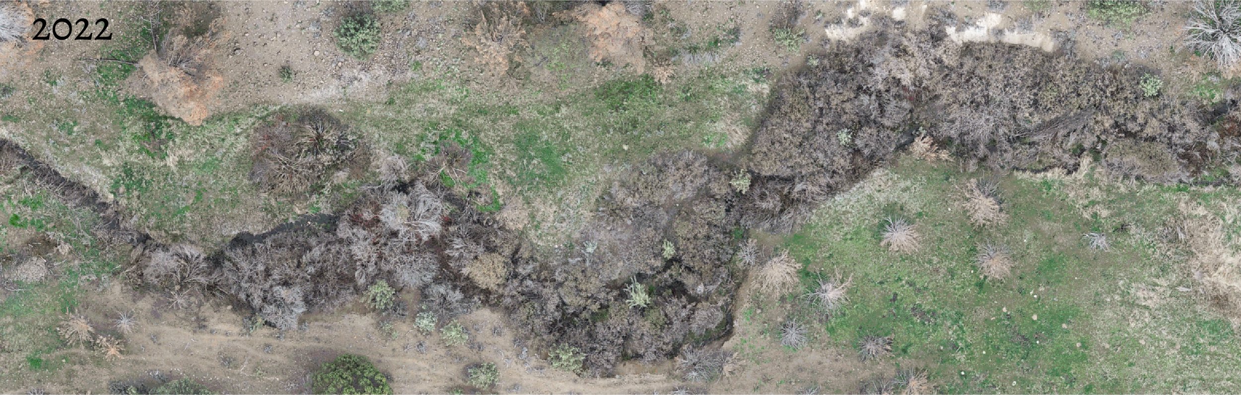
This area north of Highway 20 along the Malheur River is heavily infested with invasive annual grasses, cheatgrass (Bromus tectorum) and medusahead (Taeniatherum caput-medusae). Conversion from deep rooted perennial forbs and shrubs to invasive grasses creates huge potential for erosion as those grasses have roots that are only inches deep in the soil. This conversion also contributed to and was exacerbated by the fires in the area.
Indian Creek Fire
In 2020, the Indian Creek Fire burned through this area, burning 45,180 acres in total. The intensity in several parts of the fire removed vegetation down to the soil. Without shrub and vegetation canopy, there was very little ability to capture sediment and help dissipate flood energy or stabilize the soil.
This event would likely have occurred due to the storm intensity and terrain of the area, but the on-the ground conditions created by the invasive grasses and the fire may have contributed to the severity of the damage. Although major storm events and sediment movement are natural components of watershed systems, in this case the adverse effects including elevated sediment levels in rivers, heightened risk of future erosion, property damage, and the potential for loss of life, lead to outcomes that are far from desirable.
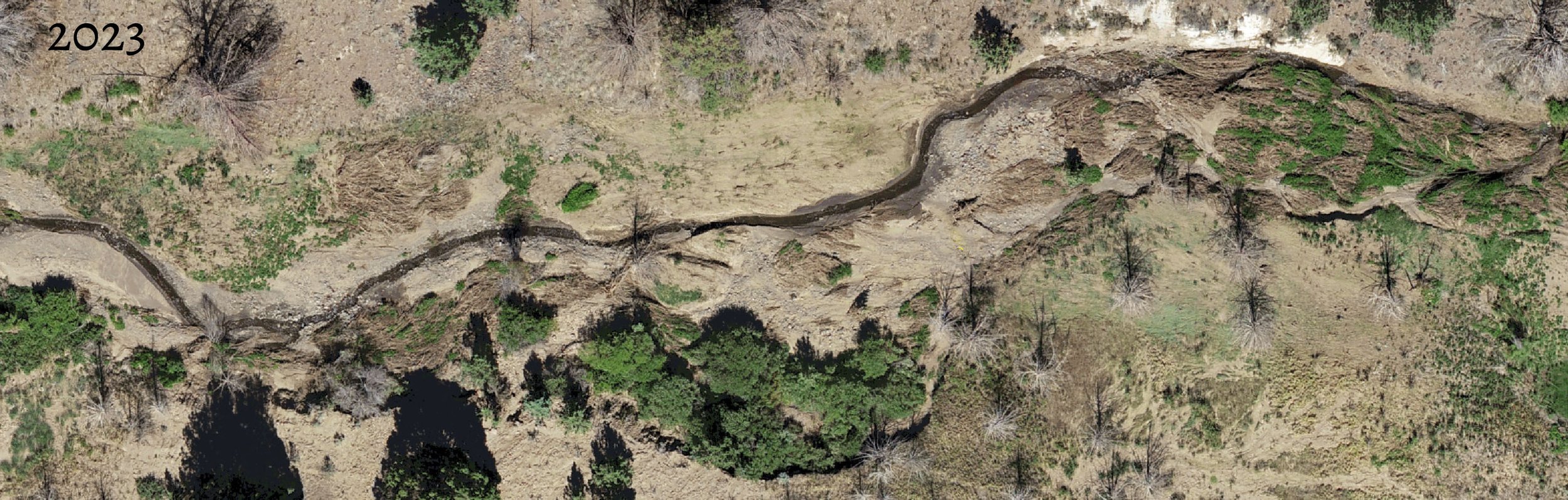
The BLM, Malheur Watershed Council and local landowner were aware of risk for erosion and movement of sediment and were working quickly to take actions to stabilize the area prior to the mudslide. Soon after the Indian Creek fire was contained the BLM wrote a Post-Fire Recovery Plan, Emergency Stabilization and Burned Area Rehabilitation, or ESR Plan. Steps were taken to control invasives and reestablish vegetation through herbicide application, aerial seeding of native grasses, and sagebrush and bitterbrush plantings.
The local landowner, the BLM and the Malheur Watershed Council were working together to continue rehabilitation and floodplain recovery after the fire, focusing efforts on Pole Creek with the Pole Creek Fire Rehab Project. Runoff and sediment from the upper end of Pole Creek were significant even in 2021, prompting this collaborative work. “The best way to mitigate the effects on streams is to ensure you have a healthy and stable riparian vegetation community that is able to withstand flood events. The plants will reduce bank erosion, capture sediment, and help dissipate flood energy” - A quote from the proposal for the project, prior to the mudslide.
The original plan included.
• Installing 120 Vertical Post Structures along 6 miles of Pole Creek.
• Cutting standing burned juniper carcasses along 6 miles of Pole Creek to 50 feet on each side of the creek. The branches will serve to slow water, allow for sediment deposition, supply detritus to feed macro-invertebrates, and provide hiding cover for redband trout.
• Planting approximately 6,300 potted plants and willow cuttings on both banks 10 feet upstream and 10 feet downstream of each structure.
All these actions were geared towards soil stabilization; however, the restoration work on Pole Creek was just beginning when the mudslide occurred. Despite proactive action being taken to prevent this, Mother Nature’s timing had the ultimate say. Now the work will continue with modifications; they redesigned the instream structures, will have to replant since about 50% of the new riparian plantings are buried, and they are aggressively seeding the uplands. With the destabilization and erosion potential of the area increased post-mudslide, these management actions are even more critical to help the area recover and avoid another similar event. Since storm events and watershed responses are largely unpredictable, a successful watershed management will take advantage of “favorable” weather or prepare for “unfavorable” weather, we just don’t always know when that is going to be.
From the inconvenience to travelers whose plans were interrupted, to the major damage done to the ranch headquarters at Jonesboro, the mudslide brought watershed function to the forefront of many people’s minds. We don’t always think about watersheds while they quietly do their work in the background, moving water from one area to the next, but when there is a major disruption in that function, it suddenly makes watersheds relevant.